Remote sensing: can it help water management on farm?
Jack Zuill, SAC Consulting
Efficient water management is vital for both productivity and sustainability in agriculture. Scottish farmers face unique challenges: from the heavy rainfall in the west to drought-prone conditions in the east. In recent years, remote sensing technologies have emerged as powerful tools to monitor, manage, and optimise water resources, helping to reduce costs, improve decision-making, and protect the environment.
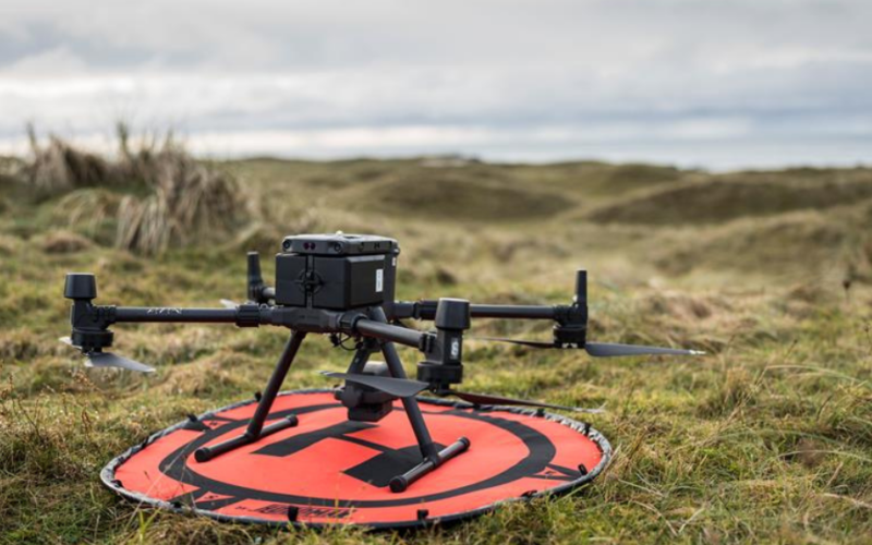
Remote sensing uses satellites, drones, and ground-based sensors to gather data about the Earth’s surface. These technologies are minimally invasive, requiring little to no direct interaction with the areas being observed, and are capable of collecting data continuously over time. By providing valuable insights, remote sensing enables effective monitoring and management of agricultural practices.
Applications of Remote Sensing for Water Management
Remote sensing offers a wide array of applications for water management in agriculture, including irrigation optimisation, drainage monitoring, flood management, water quality assessment, and the tracking of changes in farming practices. Key applications include:
-
-
Irrigation
- Optimised Planning: Satellites and drones with multispectral sensors can identify variations in soil moisture, enabling more precise irrigation planning. This helps to reduce water consumption and optimise its use.
- Drought Management: During periods of drought, remote sensing can detect areas where crops are suffering from water stress, allowing farmers to intervene promptly and manage resources more effectively.
-
Drainage
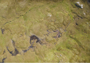
- Detection of Issues: Thermal and multispectral sensors can detect drainage problems such as waterlogged areas or regions experiencing surface erosion.
- Prevention Benefits: Early identification of drainage issues helps prevent soil erosion and crop damage, safeguarding farm productivity.
-
Flooding
- Flood Risk Alerts: Sensors can monitor water levels in upland areas, providing early warnings of flood risks.
- Damage Monitoring: Satellites and drones can track the real-time impacts of flooding, helping to assess damage for insurance claims and repair planning.
- Watercourse Monitoring: Drones can survey watercourses to identify debris or blockages that could worsen flooding risks. These methods are already being used by local councils for flood management.
-
Water Quality Monitoring
- Diffuse Pollution Management: Sensors can monitor critical points in waterways to detect changes in water quality, such as effluent discharge or algae build-up.
- Ecosystem Support: Remote sensing can assess the health of features like buffer strips, ensuring they are functioning effectively in maintaining water quality.
- Efficient Spreading: By analysing crop health, remote sensing data allows for variable rate spreading of fertiliser and pesticides, reducing costs while minimising the risk of diffuse pollution from over-application.
-
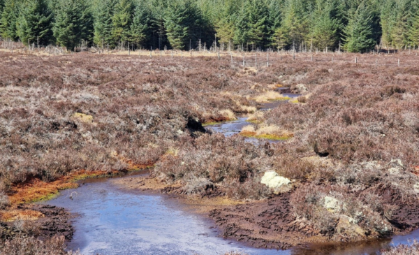
Monitoring Changes in Management Practices
- Effectiveness of New Practices: Remote sensing can assess the success of new water management interventions, such as:
 Changes in river flow following riparian woodland planting or the introduction of 3D buffer strips.
 - The effectiveness of new drainage systems in reducing waterlogging.
-
Benefits for Farmers
Integrating remote sensing into farm management offers numerous benefits, both financial and environmental:
- Cost Savings: Precision irrigation helps to reduce water bills and energy consumption. Additionally, monitoring and decision-making supported by remote sensing can minimise water-related crop damage, protecting yields and reducing financial losses.
- Environmental Benefits: Remote sensing can help reduce water waste and support sustainable farming practices by decreasing diffuse pollution. It also allows farmers to monitor and protect key environmental features, such as buffer strips and watercourses, ensuring long-term ecosystem health.
How to Get Started
For farmers interested in adopting remote sensing technologies, there are several key steps to ensure a smooth integration into farm management practices:
- Assess Your Needs: Begin by identifying which areas of your farm would benefit most from remote sensing. Whether it’s optimising irrigation, improving crop health, or reducing water-related damage, clearly defining your objectives will guide you toward the right tools and services.
- Explore Available Tools: Remote sensing technology is evolving rapidly, with a variety of tools and services available. For example, Skippy Scout is a field-walking application that uses drones to monitor crop health and stress. Other software solutions support precision guidance and variable rate application, which can help optimise crop health and reduce fertiliser and pesticide costs. Take the time to explore these options to find the ones that best suit your farm’s needs.
- Seek Expert Advice: Consulting agronomy experts or technology providers who specialise in remote sensing can provide valuable insights. They can help you understand what’s achievable and guide you in selecting the most suitable solutions for your farm.
- Start Small: Before fully integrating remote sensing across your entire farm, consider piloting the technology on a smaller area. This allows you to assess its effectiveness, understand its value, and identify potential challenges. Remote sensing technologies can be expensive to implement initially, and additional analysis from specialists or software may be required. Starting small allows you to evaluate the return on investment before scaling up.
Conclusion
By integrating remote sensing into water management practices, farmers can make smarter, data-driven decisions that improve efficiency, reduce costs, and promote environmental sustainability. This technology serves as a valuable tool in addressing the challenges of modern farming. However, it is important to conduct thorough research and implement these technologies thoughtfully to ensure that they support long-term success. When adopted wisely, remote sensing can make a significant contribution to the future of sustainable agriculture in Scotland.
Related resources
Oil Storage: How to ensure you stay safe
Andrew Wallace, SEPA
Fuel and oil are essential resources for the daily operations of farms across Scotland, but…
New Cross-Compliance Rules for Peatlands and Wetlands in Scotland
Jack Zuill, SAC Consulting
From 1 January 2025, new cross-compliance requirements under Good Agricultural and Environmental Condition (GAEC 6…
Black Gold- Valuing Slurry as a Nutrient Source
Freya Lance, SAC Consulting
2024 saw a fresh round of AECS funding for slurry storage, which has allowed a…